")
")

Pleiku Holiday Weather today
Date/time of update: July 16, 2026, 4:23 am, Timezone: GMT+7
Overcast Clouds
Temperature: 25.35°C
Temperature feels like: 25.82°C
Minimum Temperature: 25.35°C
Maximum Temperature: 25.35°C
Atmospheric pressure: 1012hPa
Humidity:72%
Visibility: 10000m
Wind speed: 5.44m/sec
Wind Direction: 268 degrees
Cloudiness: 100%
Sunrise: 2026-07-15 10:27:41
Sunset: 2026-07-16 11:19:56
The valley derives its name from the nearby Drang River in Vietnam's Central Highlands, was the site of the first major encounters between U.S Army and the People's Army of Vietnam (PAVN).
Vietnam Historical Tours, Vietnam Battlefield Tours: The Ia Drang Valley, the Battle of Ia Drang Valley
1/ Military Tactics
The Ia Drang Battle was the first time in Vietnam the US implemented the air mobility tactics in which troops were air-lifted into, supplied and extracted from the combat site by helicopters; and infantry was supported by coordinating air strikes, aerial rockets, machine guns and artillery from a far-afield firebase directed from distance by on-site observers. Air-mobility tactics were used popularly later, not only for sites of which the terrain was difficult for conventional deployment of combat forces, but also for far-afield battles.

It was in the battle of Ia Drang Valley, the PAVN found the resolution for air mobility, which later was called “grabbing the enemy by his belt to fight”. With the tactics, they would engage their enemy into a very close-ranged combats which mitigates the effectiveness of the enemy's air strikes and distant firepower. “Grabbing the enemy by his belt to fight” was later refined to more and more perfect levels taking advantage of small commando units who were masters of close-ranged combats and hand-to-hand combats; who knew the terrains of the operation areas well. They would move in and out fast and sometimes just to make the enemy fight among themselves and get injured or killed in friendly fires.

2/ Where is the Ia Drang Valley?
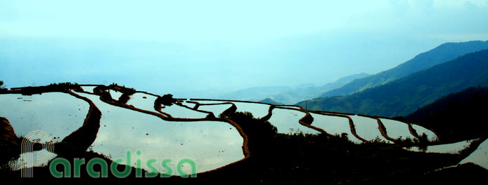
Ia Drang Valley lies at the foot of the Chu Pong Massif which, like other mountain ranges in Vietnam, runs from east to west. The area, which is about 22km west of Pleime and 60km south-west of Pleiku, is consisted of low mountains, forests, valleys with hundreds of criss-crossing small streams and rivers. The Ia Drang Valley is close to Buon Ma Thuot and to the Cambodian Border. From Ia Drang Valley, Laos is not far way either. From Pleime, the traveller can have a commanding view of the whole regions with ranges of forested mountains, one after the other, with myriad valleys in between; and farther in the horizon lines the Chu Pong Massif...

For those travellers who want to get away from dust and smoke of cities and seek tranquility and fresh nature, you can visit Ia Drang in the afternoon, especially at sunset. It is then that Ia Drang offers the mysterious beauty that hypnotizes the spectators, and it would take no time to find peace back for your soul letting your eyes wander freely into the infinity of nature of Ia Drang. Visiting the Ia Drang Valley now, it is hard to believe that once it was the site of the bloodiest and the most brutal battles which earned it the nickname “The Valley of Death”...
3/ Why the Ia Drang Valley?
Thanks to its strategic location and terrain, the area of Ia Drang Valley was where the Vietnamese stored war supplies and where the Vietnamese troops sought respite from the battles. During the Second Indochina War, Ia Drang was where the PAVN received and stored war supplies transported on the Ho Chi Minh Trails. Ia Drang and the Central Highlands of Vietnam made it convenient to launch attacks down to the coastal areas, Sai Gon area as well as its vicinity. The Central Highlands along with the Ia Drang Valley area were of vital importance to both sides during the war.

From the Fỉrst Indochina War, the Viet Minh were well-perceived and considered the Central Highlands of Vietnam of strategic importance. After successive incidents following the 1954 Geneva Accord which led to the division of Vietnam, the Central Highlands were always among the most important areas in the strategies of Ha Noi in the course of bringing pieces of Vietnam together again. From 1959, the later well-known trail - Ho Chi Minh Trails were started which made the Central Highlands and other strategic areas become the artery of supplies from North Vietnam into the South.
4/ Historical Context
By 1964, there had been dramatic changes in the politics of South Vietnam Republic. President Diem was assassinated in a coup: the horse was changed in midstream. Following Diem's death were successive coups and counter-coups and struggles for power in the politics of South Vietnam Republic.

The original plan having been using US military advisers and US-trained Army Republic of South Vietnam to fight the People's Army of Vietnam and the Army of the National Front for the Liberation of South Vietnam had been proved a failure: the Army Republic of South Vietnam did not want to fight and did not have the capability to fight; Liberated Zones mushroomed in South Vietnam, the people of South Vietnam were not enthusiastic with the corrupt government and the corrupt army. The people were not interested in the No. 10 Law (1959) which would apply the guillotine punishment to any one if they were doubted with any involvement with the Viet Cong. The strategies needed a change...
After the Tonkin Gulf Incident and the Tonkin Gulf Resolution, Johnson's government had “the blank check” from the US Congress in August 1964 to escalate the war in Vietnam which led to the direct deployment of the US Army in South Vietnam and the saturation bombings of North Vietnam in the same year.
5/ The Ia Drang Battle and Aftermath
In July 1965, the 1st Cavalry Division consisted of 3 Brigades was assigned to deploy to Camp RadCliffe at An Khe. In November 1965, the 3rd Brigade of the 1st Cavalry Division was sent into a Search and Destroy Mission to track down the PAVN Forces which attempted to attack the Special Forces Camp at Pleime earlier. They had searched for several days until tracking down some signs of these forces at the foot of the Chu Pong Massif.
From November 14th through November 18th, Ia Drang was the site of a series of the bloodiest battles. After the Ia Drang Battles, the US Army left the field leaving the PAVN to control the area. PAVN controlling the Chu Pong Mountain as well as the Vietnam-Laos-Cambodia border regions means the Dong Truong Son Roads (the eastern legs of Ho Chi Minh Trails) were still secured for the flows of war supplies from North to South Vietnam...
Visiting the Ia Drang Valley now we can not find any traces of the once bloody battles. Wild nature has healed all the wounds and scars of war. Ia Drang Valley now is dotted with wild little flowers which secure those who rest here a permanent peace...
6/ How to visit Ia Drang Valley?
The Ia Drang Valley is under the administration of the People's Army of Vietnam nowadays. It is a restricted area and foreign visitors are not allowed in the valley. Still, you can have good views of the Ia Drang Valley from Pleime Hill.
In this article as well as in other articles on our website, when we mention a tour to the Ia Drang Valley then it means that a tour to have views of the Valley from Pleime only.
Paradissa offers half a day tour to the Valley which is also combined with a visit to Mount Dragon (the base of the mountain only), site of former Camp Enari - the former Headquarters of the 4th U.S Infantry Division. For those of you having more time, then you can visit various other former battlefields in Gia Lai and Kon Tum Provinces. The base city for these trips can be Pleiku or Kon Tum. Please contact Paradissa for a suitable trip.
7/ When to visit?
It is advisable to take a tour to the Ia Drang Valley in the dry season which is from December through April.
Pleiku Average Monthly Rainfall and Temperatures


, Dien Bien Phu Battle")


