")
")

Tinh Ha Giang Holiday Weather today
Date/time of update: July 5, 2026, 12:45 am, Timezone: GMT+7
Overcast Clouds
Temperature: 27.23°C
Temperature feels like: 30.7°C
Minimum Temperature: 27.23°C
Maximum Temperature: 27.23°C
Atmospheric pressure: 1004hPa
Humidity:84%
Visibility: 10000m
Wind speed: 0.91m/sec
Wind Direction: 323 degrees
Cloudiness: 100%
Sunrise: 2026-07-04 10:19:42
Sunset: 2026-07-05 11:48:57
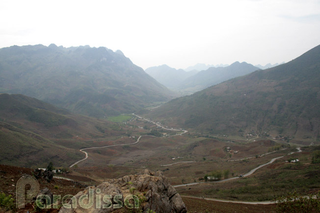
Quan Ba is a district of Ha Giang Province to the far-north of Vietnam. The capital town of Quan Ba is Tam Son, 50km north of Ha Giang provincial capital. The land is part of the famed Dong Van Plateau which is listed to the Global Geoparks Network by the UNESCO. Quan Ba shares a border of 54km with China to the north and west.
Geography
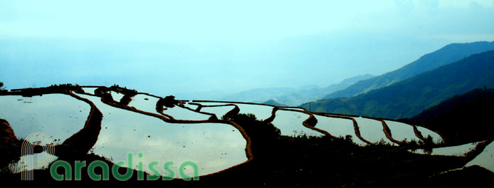
Quan Ba has a mountainous terrain with averaged altitude of 1,000m above sea level. Agricultural land accounts for only 30% of the total area while most of the rest is limestone mountains. The Mien River, which starts the course in China, has 12km in Quan Ba.

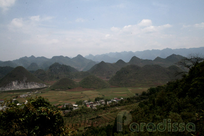
Fabled limestone mountains of Quan Ba, Ha Giang
Weather and Climate
The temperatures are cool all year round and there are two seasons: dry season from November through March, rainy season from April through October.
People and Population
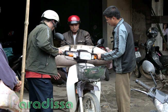
Small in area it may be, but Quan Ba is home to 16 groups of ethnic groups: Hmong (60%), Dao (14%), Tay (9%)… As the land was separated from the mainstream society for a long time, their traditional cultures remain much untouched.

Panoramic view of Quan Ba from the Gateway to Heaven
Economy
Quan Ba is a poor district; the local economy is based on trade with China across the border which has been nothing and agriculture which is based on poor soil. Until recently, staple of local communities was mostly corn the amount of which was not even enough. With peace back to the border regions in Ha Giang in 1991 and promotion of tourism in the late 2000s, there seems some lights at the end of the tunnel for the life of local inhabitants.
Travel Guide, What to see, Things to do, Tourist Attractions Quan Ba, Ha Giang
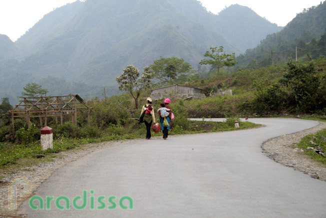
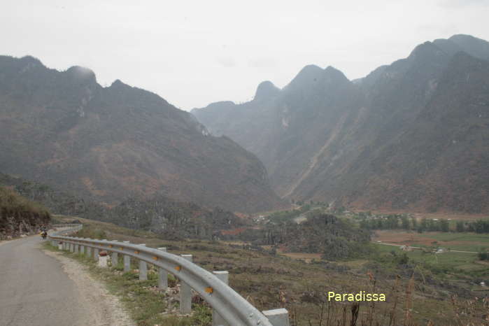
Tourism in Quan Ba includes: the breathtaking natural landscape and the traditional ethnic cultures. The limestone mountains are breathtaking and you can go motorcycling, mountain-biking or trekking to adore the amazing beauty. For those without much love for adventure travel, you can take in the beauty just by the roadside of Route 4C which travels through much of the district.

Scenic mountains and meandering road of Quan Ba, Ha Giang
1/ Heavenly Gate
From Ha Giang City, the road goes up forever and you’ll find yourself traveling on mountainsides lifting up more and more… Then it comes to a plateau area with myriad mountain peaks in view. Do not miss climbing the high point of the Heavenly Gate (Pearl Gate) to take in the stunning nature around!
2/ Tam Son Town with the Twin Mountains, Nam Dam Village, Lung Tam Village
Traveling further you will adore the little scenic town of Tam Son from above, there come into view the twin mountains which resemble huge tits. From Tam Son if you turn right and travel for 6km further you’ll arrive at Nam Dam, a Dao community, a different world with lovely mountains and idyllic valleys. Staying overnight with a family is a good experience to tune in local way of life.
A couple of kilometers from Nam Dam is Lung Tam, a Hmong hemp-weaving village. There is a good chance to acquire authentic brocades made by Hmong ladies here. Around both Nam Dam and Lung Tam, there are several hiking paths that may lead you to more lovely landscapes and amazing encounters… If you are armed with enough food and water, do not hesitate to make a daring adventure further from Lung Tam; you’ll be in rarely visited world with stunning nature of Lung Ho, Du Gia, Ngam La...

The Mien River amid mountains at Quan Ba, Ha Giang
3/ Rock Plateau
From Tam Son Town, If you continue uphill Route 4C, you’ll make your way into the heart of the amazing rock world of Dong Van Plateau. The scenery gets more and more unreal like in a fairy tale! You’ll have big problems without enough battery and memory for your camera! There are millions of trails leading you off the main road into the infinity of rock but you will not have time for them all!
The last leg of road of Quan Ba along Route 4C offers lovely riverside landscape with amazing mountains on both sides for several kilometers before you find yourself into the fantasy of Yen Minh. The mountains in this area bear gray colors which have quite a different look.
Where to stay, Accommodations
There are basic hotels in Tam Son Town and homestay with poor conditions in Quan Ba Area. There have been virtually no luxury properties in Ha Giang just yet. Fans of luxury travel may have to sacrifice amenities or wait till conditions change substantially.
Where to eat, restaurants in Quan Ba
There are simple restaurants in Tam Son Town which offer food for only certain hours of the day.
How to get there and way
Tam Son Town is 50km north of Ha Giang and 50km southwest of Yen Minh Town, 100km southwest of Dong Van Town. There are local buses daily between Ha Giang City and Quan Ba, but the service and safety conditions are poor.


, Dien Bien Phu Battle")


