")
")

Bac Kan Holiday Weather today
Date/time of update: June 15, 2026, 12:28 am, Timezone: GMT+7
Overcast Clouds
Temperature: 25.82°C
Temperature feels like: 26.91°C
Minimum Temperature: 25.82°C
Maximum Temperature: 25.82°C
Atmospheric pressure: 1005hPa
Humidity:94%
Visibility: 10000m
Wind speed: 0.52m/sec
Wind Direction: 40 degrees
Cloudiness: 99%
Sunrise: 2026-06-14 10:12:48
Sunset: 2026-06-15 11:41:25
Bac Kan Province is situated in the North-East of Vietnam, bordered to the north and north-east by Cao Bang Province, to the east by Lang Son Province, to the south by Thai Nguyen Province and to the west by Tuyen Quang Province. Bac Kan Town, the provincial capital of Bac Kan Province, is 160km from Hanoi via Route 3.

A house on stilts of the Nung People at Bac Kan Vietnam
Bac Kan Geography
Bac Kan has mountainous terrain of which most of the surface is forested. Some areas of the province have typical karst terrain. The terrain is higher to the north and lower to the south, higher to the east and the west and lower in the middle. Either the east or the west is characterized with high mountains running north-south with mountain peaks of over 1,000m above sea level. The middle is a series of valleys and river basins.
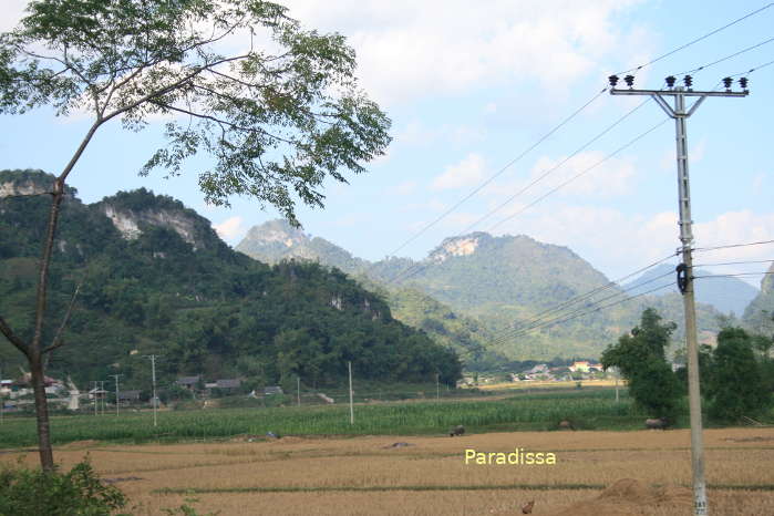

The green countryside of Bac Kan Vietnam
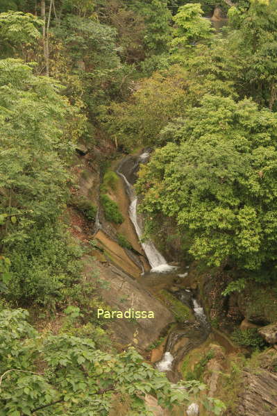
The 5 big rivers in the province are the Lo River, the Bang River, the Gam River, the Ky Cung River and the Cau River. Besides, the province has the Ba Be Lake which is a huge lake in the mountains.

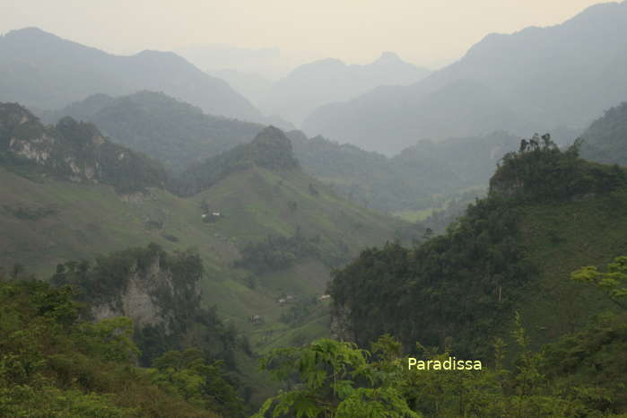
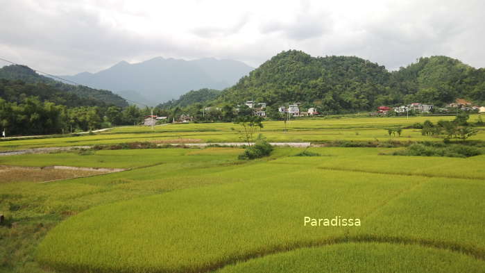
Mountains at Cho Don, Bac Kan
Bac Kan Climate
Bac Kan has a tropical monsoon climate with four seasons per annum. The average temperatures range from 20-25 Degrees Celsius and the average rainfall in Bac Kan is 1,400mm-1,600mm per annum. The rainy season is from May through October and the dry seasons is from November through April.
Thanks to the series of high mountains to the east which block the southwesterly monsoon in the summer that lessens the annual rainfall and the impact of seasonal typhoon. But the high mountains to the east and the west facilitates the northeasterly cold winds and preserves the low temperatures which makes the winter here colder.
Flora and Fauna in Bac Kan
The land is home to a rich system of flora and fauna including many endangered species such as the white-cheeked monkeys and the special pine family (Thiet San Gia or Thong Da in Vietnamese). The rich diversity of the flora and fauna systems can be found at the Ba Be National Park and Kim Hy Nature Reserve. The exploitation of local mineral resources has put a serious threat to the ecosystem of the province.
People and Population in Bac Kan
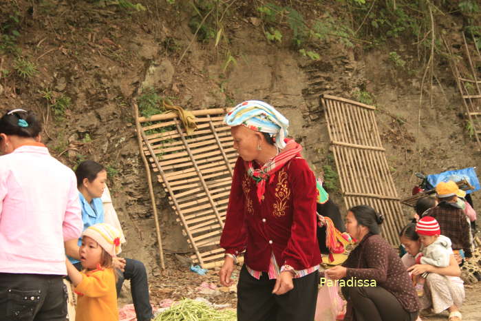
The local population includes 7 ethnic groups: the Kinh, Tay, Nung, H'mong, Dao, Hoa and San Chay. Most of the population lives on agriculture and forestry. Though each ethnic group has their own culture and language, there are many common cultural practices and traditions among the groups.
Bac Kan Travel Guide, Tourist Attractions, What to See in Bac Kan
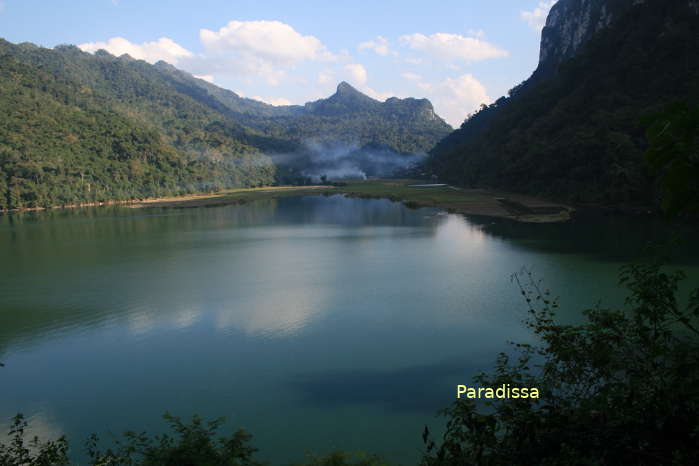
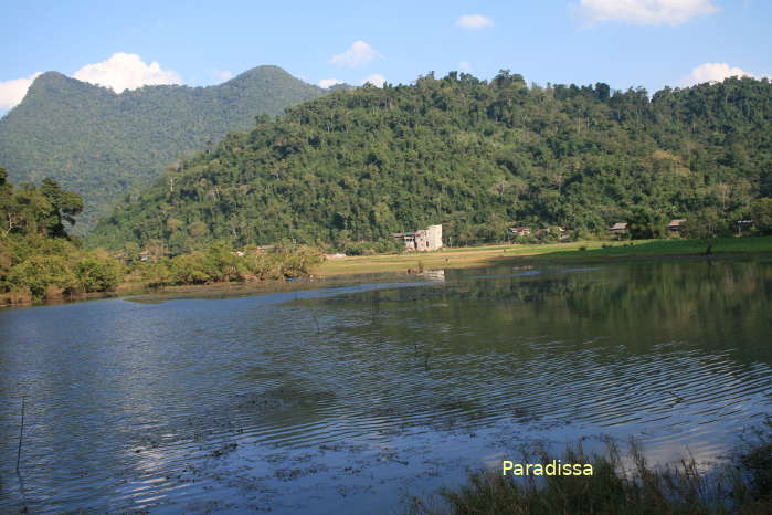
1/ Ba Be National Park, Ba Be Lake
Ba Be Lake and Ba Be National Park is listed as a UNESCO Ramsar Site. A trip to visit the lake takes a full day and another full day is required for a trip to explore the national park.

Ba Be Lake, Ba Be National Park, Bac Kan, Vietnam
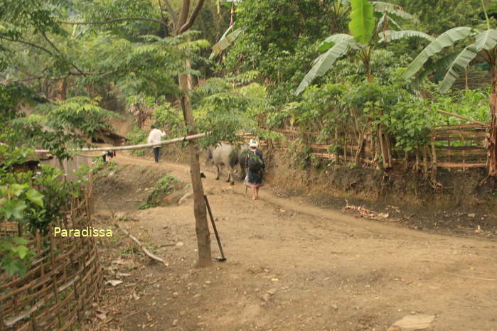
2/ Ethnic villages
Ethnic villages are scattered around the Ba Be National Park. Visiting these villages require trekking tours for 2-3 days.

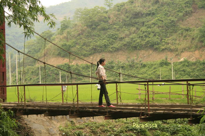
Pac Ngoi Village, Ba Be National Park, Bac Kan, Vietnam
3/Former battlefields
Bac Kan was the seat of the Democratic Republic of Vietnam Government during the war against the French colonialist in 1946-1954. The French launched operation Lea in 1947 trying to capture the Viet Minh’s headquarters with failure. The remarkable sites to visit include the former Phu Thong French Stronghold, Giang Pass (Ngan Son), Cho Don Township...

Bac Kan City was the site of a major battle between the French and the Viet Minh in 1947
4/Na Khoang
This site is an ecotourist site at Deo Gio (The Windy Pass) at Na Phac where couples can seek privacy amid the wilderness.
Things to do, Travel and Tours in Bac Kan
1/ Adventure Tours, Trekking Holidays, Eco Tours in Bac Kan
Bac Kan has great potential for tourism, especially for adventure travel and eco-tourism. Paradissa Travel offers trekking tours at Ba Be National Park; eco-tours at Ba Be National Park and Kim Hy Nature Reserve; biking and motorbiking tours through Bac Kan and neighboring provinces. Currently, infrastructure for tourism at Bac Kan is still in lack and luxury travel is not expected in the province any time soon.
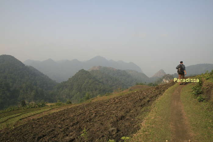

Ngan Son Township
2/Relaxing Family Vacations in Bac Kan
If your family has kids or senior travelers and would like more of a relaxing vacation amid fresh nature, Ba Be National Park is definitely recommended. You can take easy trails in the national park, by the lake or enjoy a boat trips to visit the different sites.

A scenic valley at Cho Don, Bac Kan
3/ Battlefield Tours
Bac Kan was among the region called the Revolution Capital that served as the base for the Vietnamese resistance war during the French times. Paradissa hosts a special battlefield historical tour for war veterans and historians to travel back to the sites of the former battles between the Viet Minh troops and the French troops. The tour provides you with information and analysis of the events which occurred back in time and which assists you with in-depth understanding of a chapter of the Vietnamese history.
Where to stay, Hotels and accommodation in Bac Kan
There are several basic hotels with clean rooms at Bac Kan City, Ba Be National Park, Cho Ra Township, Ngan Son, Cho Moi Town, Cho Don Township. There is only one 3-star hotel at Bac Kan City and there has been no luxury travel service at Bac Kan just yet.
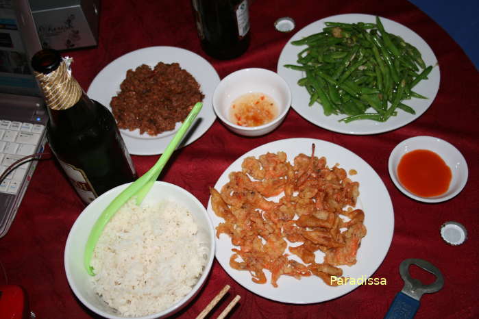
There are several homestays at Ba Be National Park where you can have a great peaceful holiday amid pristine nature. The facilities are simple but the cozy atmosphere with wonderful natural settings and great food makes it an unforgettable experience.
How to get there and away/How to get around Bac Kan
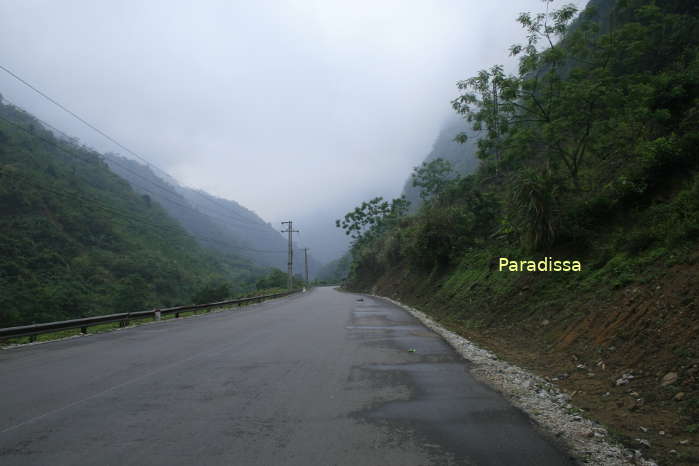
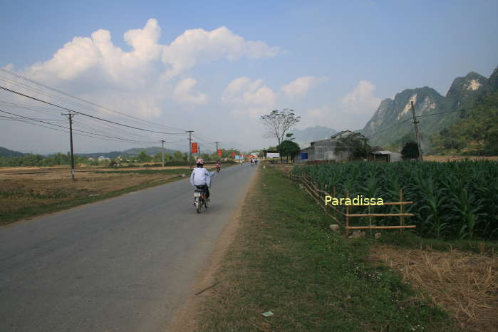
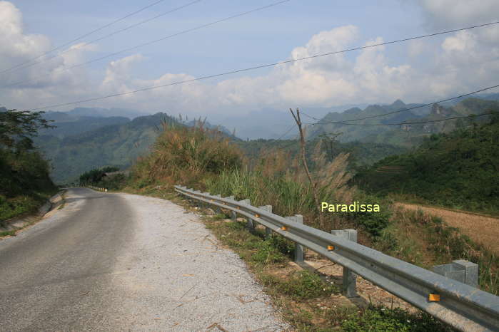
Bac Kan City is 160km north of Hanoi via Route3 which is in good conditions. Ba Be National Park is 70km northwest of Bac Kan City and 220km from Hanoi via Route 3 and Route 254. All the routes from Hanoi to Bac Kan City and from Hanoi to Ba Be Lake have spectacular landscape.
Bac Kan Average Monthly Rainfall and Temperatures


, Dien Bien Phu Battle")


