Vietnam Destinations
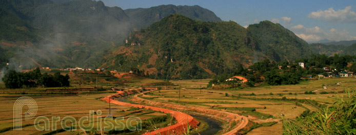 When you plan to embark for a holiday to Vietnam, the first question in your mind is normally where to go and what to see in the country? The Vietnam destinations section includes travel information and travel guide for all major travel and tourist destinations in Vietnam. For specific information related to a tourist attraction or tourist spots, you may like to visit the Vietnam Tourism section.
-
An Giang
An Giang is located to the west of the Mekong Delta in southern Vietnam. The province is bordered to the east by the Hau River and Dong Thap Province, to the south by Can Tho, to the south-west by Kien Giang, and to the west by Cambodia (Kandal and Takeo Provinces).
Country: VietnamProvince: An Giang -
Ba Ria - Vung Tau
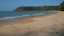
Ba Ria – Vung Tau, located to the south-east of Ho Chi Minh City, is home to several sandy beaches which are popular at weekend for wealthy travelers from Saigon. The province is one of the biggest economic centers in southern Vietnam.
Country: VietnamProvince: Ba Ria - Vung Tau -
Bac Giang

Bac Giang Province is bordered to the north and north-east by Lang Son, to the east and south-east by Quang Ninh, to the south by Hai Duong and Bac Ninh, to the south-west by Hanoi and to the west by Thai Nguyen. Bac Giang is not much known to the travelers to Vietnam. There is not really good infrastructure for tourism in the province yet.
Country: VietnamProvince: Bac Giang -
Bac Kan
Bac Kan Province is situated in the North-East of Vietnam, bordered to the north and north-east by Cao Bang Province, to the east by Lang Son Province, to the south by Thai Nguyen Province and to the west by Tuyen Quang Province. Bac Kan Town, the provincial capital of Bac Kan Province, is 160km from Hanoi via Route 3.
Country: VietnamProvince: Bac Kan -
Bac Lieu
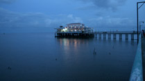
Bac Lieu is 280km southwest of HCMC, 49km southwest of Soc Trang, 212km southwest of Tra Vinh. Bac Lieu Province is bordered to the north-west by Hau Giang and Kien Giang Provinces, to the east and north-east by Soc Trang Province, to the south and south-east by the East Vietnam Sea and to the west and south-west by Ca Mau Province. Bac Lieu Province has 56km of coastline.
Country: VietnamProvince: Bac Lieu -
Bac Ninh

Bac Ninh is a province with small land area in the Red River Delta in northern Vietnam. The province is home to much of the old culture of Vietnam such as ancient villages, old architectures, Quan Ho Quan Ho folk songs, the unique costumes called Ao Tu Than or Ao The Khan Xep (Long dress with long pants and a head-dress) for men and girls. Nowadays, Bac Ninh is one of the major industrial and economic centers of Vietnam.
Country: VietnamProvince: Bac Ninh -
Bat Xat
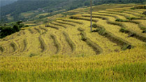
Bat Xat District of Lao Cai Province is located to the north-west of Lao Cai City; bordered by China to the north-east, north and north-west; to the west and south-west by Lai Chau Province; to the south by Sapa and to the south-west by Lao Cai City.
Country: VietnamProvince: Lao Cai -
Ben Tre
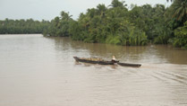
Ben Tre is one of the provinces of the Mekong Delta in southern Vietnam, bordered to the north by Tien Giang Province, to the east by the East Vietnam Sea, to the west by Vinh Long Province and to the south by Tra Vinh Province. Ben Tre is 90km from Ho Chi Minh City.
Country: VietnamProvince: Ben Tre -
Binh Dinh

Binh Dinh is in the south of the Central Region of Vietnam. Binh Dinh is bordered to the north by Quang Ngai, to the east by the East Vietnam Sea, to the south by Phu Yen and to the west by Gia Lai.
Country: VietnamProvince: Binh Dinh -
Binh Duong
Binh Duong is in the intermediate region between the Central Highlands of Vietnam and the Mekong Delta in southern Vietnam. The province is bordered to the north by Binh Phuoc, to the east by Dong Nai, to the south by Ho Chi Minh City (Saigon) and to the west by Tay Ninh.
Country: VietnamProvince: Binh Duong -
Binh Phuoc
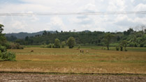
Binh Phuoc is the intermediate region between Vietnam’s Central Highlands and the flat Mekong Delta. Binh Phuoc is bordered to the north by Cambodia, to the north-east by Dak Nong, to the east by Lam Dong, to the south-east by Dong Nai, to the south by Binh Duong, to the south-west by Tay Ninh, to the west and north by Cambodia.
Country: VietnamProvince: Binh Phuoc -
Binh Thuan
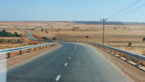
Binh Thuan Province is located in the South Central Coast of Vietnam, bordered to the north and north east by Ninh Thuan Province, to the north and north-west by Lam Dong Province, to the west by Dong Nai Province, to the south-west by Ba Ria Vung Tau Province and to the east by the East Sea of Vietnam. The terrain of Binh Thuan is mostly forested mountains to the west and flat land along the coast.
Country: VietnamProvince: Binh Thuan -
Buon Ma Thuot
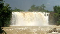
Buon Ma Thuot or Ban Me Thuat is located deep in the Central Highlands, about 360 km from Sai Gon. Buon Ma Thuot is the capital city of Dak Lak Province of Vietnam and the "capital city of the Vietnamese coffee". Buon Ma Thuot by far is relatively off-the-tourist track. But the area is certainly worth the trip.
Country: VietnamProvince: Dak LakDistrict: Buon Ma Thuot -
Ca Mau
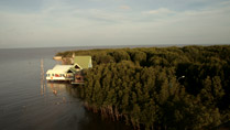
The inland area of Vietnam looks similar to an S shape, the bottom area of the country is the Mekong Delta and the southernmost area of the Mekong Delta is Ca Mau. This is where the inland of Vietnam protrudes into the East Vietnam Sea of which the tip is Cape Ca Mau. Cape Ca Mau is where you can observe both sunrise and sunset on the sea.
Country: VietnamProvince: Ca Mau -
Can Tho
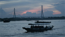
Can Tho is the capital city of the Mekong Delta of Vietnam with an area of 2,965 square km and a population of 1,820 people (2004).
Country: VietnamProvince: Can Tho -
Cao Bang
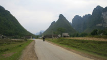
Cao Bang is a mountainous province located in the North East of Vietnam. The province is bordered to the north and the east by China, to the West by Ha Giang Province and to the south by Lang Son, Bac Kan and Tuyen Quang Provinces. Cao Bang has a borderline of 333km with China.
Country: VietnamProvince: Cao Bang -
Cat Ba Island

Cat Ba Island is located south of Ha Long Bay, the island is under the administration of Hai Phong City.
Country: VietnamProvince: Hai Phong -
Chau Doc
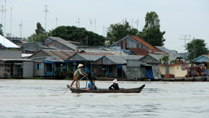
Chau Doc is an idyllic riverine town located close to the Cambodian border and inhabited by the communities of Kinh, Cham, Khmer and Chinese. There are numerous pagodas in Chau Doc which have Chinese and Hindu influence and which are colorfully painted.
Country: VietnamProvince: An GiangDistrict: Chau Doc -
Da Lat

Da Lat is located on the Lang Biang Plateau, southern area of the Central Highlands of Vietnam. Da Lat is characterized by pine forests, lakes, waterfalls, beautiful flower fields and French architecture.
Country: VietnamProvince: Lam DongDistrict: Da Lat -
Da Nang
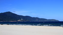
Da Nang City in Vietnam is the biggest commercial and industrial city in the Central Region of the country. Da Nang is among the most popular travel destinations in Vietnam with those of the finest sandy beaches in the country and in the world.
Country: VietnamProvince: Da Nang
Page 1 of 5


