")
")

Tinh Yen Bai Holiday Weather today
Date/time of update: June 30, 2026, 1:56 am, Timezone: GMT+7
Heavy Intensity Rain
Temperature: 25.33°C
Temperature feels like: 26.43°C
Minimum Temperature: 25.33°C
Maximum Temperature: 25.33°C
Atmospheric pressure: 1006hPa
Humidity:96%
Visibility: 10000m
Wind speed: 0.74m/sec
Wind Direction: 137 degrees
Cloudiness: 100%
Sunrise: 2026-06-29 10:21:57
Sunset: 2026-06-30 11:47:35
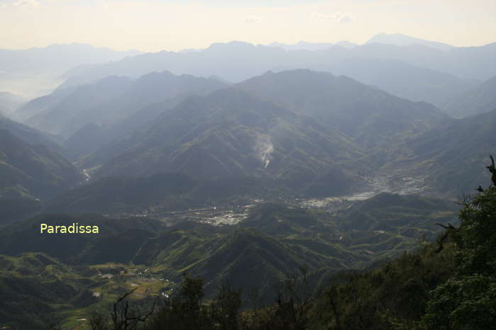
The Ta Xua Mountain in Tram Tau District of Yen Bai Province, which is 2,865m above sea level, is the 10th highest mountain peak in Vietnam.
Travel Guide to the Ta Xua Mountain, Yen Bai
The best time to climb Ta Xua
The best time to climb the Ta Xua Mountain is from November to early April during which it is normally dry and fairly cool temperatures. If you want to take photos of an ocean of clouds on the trek to the top, then you may want to take the trip from November through the first half of March. It is freezing cold from late November through early February.
")
The trek to the summit of the Ta Xua Mountain starts at the Ta Xua Village (Hmong People)
You may get lovely clouds in September and October but there are sometimes typhoons or tropical depressions during this period which make it rain incessantly for a few days and climbing the mountain is not possible.
From May through July, the strong sun along with unpredictable summer rains can make the adventure to Ta Xua very difficult, too.

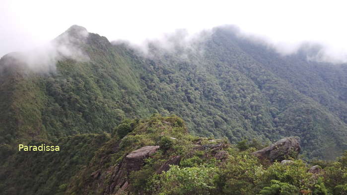
A view of the mountains on the trek
How to get there
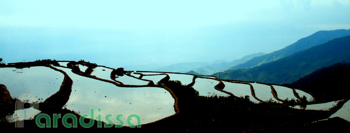
It is 17km from Tram Tau Township to the highest peak of the Ta Xua Mountain of which for the first 4-6km you are transferred by scooter/motorbike. This part of the route is a steep dirt path which is extremely slippery when it is wet. There are rice terraces on both sides of the road that you may like to stop a couple of times for some photographs.

A view of the surroundings from a thin forest on the trek
What the trek is like
The trek starts at the Ta Xua Village (Hmong People) perched high on a mountain slope. The steep path is the one villagers use to go hunting in the mountains. It is also where rain water flows down washing away the soil that the surface is quite uneven and slippery when it is wet. It is a thin forest here that there is not enough cover from the sun, and you’d need a sunhat. After 1 hour and a half then you’ll start having views of the Tram Tau Township and some villages.

The 45-degree path on the hike up to the 1st peak of Ta Xua
For an averaged trekker, it should take you about 5 hours to get to the Turtle Head Boulder where you could have breathtaking views of the surrounding. It is 45-degree gradient all the way from the Ta Xua Village to the Turtle Head Boulder! And several parts of this part offer nothing for you to cling to going up (or down). The Turtle Head Boulder is a great stop for lunch, too. The wind is quite pleasant up here. There is no shade here but the temperatures are often pleasant.

A lovely bird eye's view of the mountains around Ta Xua
From the Boulder to the first hut it takes 2 hours, the path is gently sloping amid low bushes of bamboos and ferns. The winds often make your hike quite pleasant and the views of breathtaking mountains around make your adventure even more sensational. Try your best to savor the scenery as you have nothing to hurry for and you’ll more likely reach the hut at mid afternoon or a bit later. Leave your luggage at the hut and proceed to the Dinosaur’s Spine – the most challenging part of the adventure to the top.

The Turtle Head Boulder near the 1st Peak of Ta Xua
The Dinosaur’s Spine, which is only a couple of hundred meters in length, is on the altitude of about 2,400-2,500m. It is only a couple of meters in width connecting the two main branches of the Ta Xua Mountain. The tiny path, which is barely enough for one of your feet at a time, goes down vertically and up vertically. There are several parts on this path that you can only rest the tip of your foot and not the whole foot at a time. It is virtually vertical steep and you can cling to roots or small trees to make yourself up or down.

A breathtaking view of the mountains around Ta Xua from the Turtle Head's Boulder
There are a few times that there is absolutely nothing for you to cling to and you have to push your body leaning against the cliff to move further forwards. If your foot does not rest firmly or slides, it is hundreds of meters below that the fall will be. It takes 1.5 hour or 2 hours to pass this treacherous part of the adventure and most will have been tired reaching the other side of the mountain. The winds blow through the mountain gorge which is sideways as you travel on the Dinosaur’s Spine and it makes your hike even more difficult and dangerous.


, Dien Bien Phu Battle")


