")
")

Lao Cai is home to the highest mountain peak in Vietnam, Mount Fansipan. Nestled at the base of Mount Fansipan is Sapa Town, one of the most popular hill stations in the country. Both Sapa and Mount Fansipan have been turned into a money making machine and lots of constructions have been going on here. The town and the mountain are losing the pristine charm and the adventure travelers are looking for alternatives...
Travel Guide to the Lao Than Mountain in Lao Cai
1/ Mount Lao Than, an Off-the-Beaten-Track Adventure Destination
 If you are looking for untouched natural beauties and cultures, and if you are looking for conquering high mountains, then those in Bat Xat District of Lao Cai Province may offer all that you wish for. Here, we are not trying to compare beauties; we simply want to let you aware that you may feel very sorry to know that you have missed an opportunity to experience a fresh beauty that you always dream of...
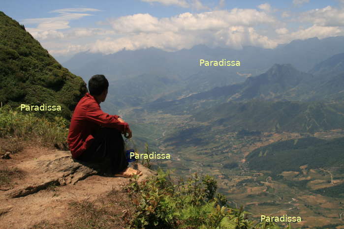
Mount Lao Than at Phin Ho Village, Y Ty Commune is of 2,860m above sea level. The average altitude of Y Ty is more than 2,000m above sea level with cool climate all year around and with heavenly landscape. Once you get to the summit of Mount Lao Than, you'll see other mountain peaks of more or less than 3,000m above sea level just in close proximity. Taking all these mountains into one trip may be too much. Visiting Y Ty ethnic villages and climbing Mount Lao Than is just ideal taking into account different aspects: time, budget, physical requirement, cultural experience.

2/ What the trek to the summit of Mount Lao Than is like?
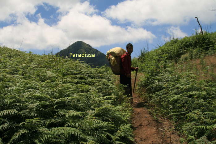
You can climb Mount Lao Than and come back within a day or you may like to spend a night in a camp near the summit. First you'd need a transfer by car or motorbike for 7km from Y Ty center to Phin Ho Village where the trek starts. The hike to the campsite (2,560m) from the mountain base takes about 3-5 hours depending on your fitness and the stops for photos. The hike from the campsite to the summit takes 1-1.5 hour and the descent from the summit to the campsite takes 30 minutes. The descent from the campsite back to the mountain base takes about 2 hours plus.
The first leg of the hike is through a pasture with thin forest and with  mild gradients. The second leg is through a thick forest with old trees and with steep terrain. Then, the path is mildly going up all the way through fern bushes to the campsite. There are vantage points here that you may like to spend hours there to take photos of the nearby mountains and valleys. The hike from the campsite to the summit is very steep without anything to cling to; take your ascent with care then. Once at the summit, you'll be rewarded with a 360-degree magnificent view of the surroundings.
3/ Mount Lao Than is on the adventure travelers’ map
As of writing, responsible officials from Lao Cai Province and Bat Xat District have taken a couple of FAM trips to Y Ty and Mount Lao Than. They are seriously considering the possibilities of promoting local tourism. It's just that at the moment, foreign visitors are still required to have a permit from the provincial police due to that Y Ty is just right on the border between Vietnam and China and visits to the area are subject to regulations applicable to border areas. Once these rules are lifted, it is no doubt that the number of foreign visitors to Y Ty will skyrocket in no time...

Scaling the summit of Lao Than Mountain

View looking southeast from the summit of Lao Than, the Red River dividing Vietnam and China

On the top of Mount Lao Than

Adoring the mountain peaks to the south of Lao Than, they are for the coming adventures...

Charming view from the campsite


, Dien Bien Phu Battle")


